THE CITY MUNICIPALITY OF VOZDOVAC
Vozdovac, one of seventeen Belgrade municipalities, is the southern gate of Belgrade. It connects the old downtown with the suburban settlements. To the south of it there are the Avala Mt., villages and settlements underneath the Avala Mt. next to the European corridor – the Belgrade – Nis Highway. It was opened to traffic in 1963, with one, and in 1977, with two separate lanes, bringing Vo`dovac Municipality to the international arterial road and carrying on the tradition initiated after the First World War, when the Avala road was constructed as the first road with two lanes in the Kingdom of Yugoslavia, intended for automobile traffic.
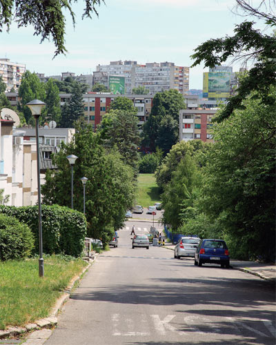
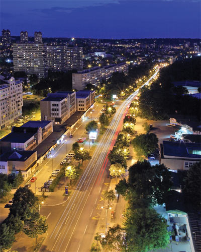
In the second half of the 20th century, in the territory of this City Municipality, outside its up-to-then urbanized part – the old Vozdovac, Pasino brdo-Hill, and Dusanovac – new urban settlements were constructed: Sumice, Konjarnik, Braca Jerkovic, Medakovic, Banjica, Kumodraz and, as the latest one – the settlement of Stepa Stepanovic, completed in December 2012. This residential and business complex with supporting facilities on the space of the former barracks was designed for 13,300 inhabitants and it is the largest residential settlement in Serbia constructed in the past three decades. Well connected with the center of Belgrade, all those Vo`dovac settlements offer comforts of living in a natural environment with abundance of greenery, free space, and landscaped parks.
Its central position in the territory of Belgrade makes Vozdovac Municipality a neighbor of eight other Belgrade municipalities. At Autokomanda Square, Vozdovac meets Vracar and Savski venac municipalities. The northern „border“ towards Vracar goes along Ustanicka and Gospodara Vucica Streets to Vojislava Ilica Street, and the eastern one
towards Savski venac Municipality – along Bulevar oslobodjenja, Veljka Lukica Kurjaka, Crnotravska, Borska Streets to the Banjicki road.
Towards the west, the border with the Municipality of Rakovica goes along the Banjicki road, Plitvi~ka Street, along the Jelezovacki potok-Brook, and along the boundaries of the cadastral municipalities of Jajinci and Stara Rakovica. Next to the cadastral municipalities of Pinosava and Rusanj up to the district of Ripanj – it is the border with ^ukarica Municipality and, towards the southwest, between the cadastral municipalities of Ripanj and Barajevo, Vozdovac is in contact with Barajevo Municipality.
The border with Sopot Municipality goes along the limits of the adjacent cadastral municipalities towards the south and, towards the east, with Grocka Municipality. From Veliki Mokri Lug district along the highway towards Belgrade up to Vojislava Ilica Street and along it up to Gospodara Vucica Street – it is the border with Zvezdara Municipality.


ON THE COASTS AND AT THE BOTTOM OF THE ONETIME SEA
Geographical determinants of the City Municipality of Vozdovac are as follows: it is situated at a latitude of 44 degrees, 46 minutes and 42 seconds north, and a longitude of 20 degrees, 28 minutes and 33 seconds east. It covers an area of 148 square kilometers or, to be precise, of 14,864 hectares. The climate is moderately continental with an average precipitation from 636 to 687 millimeters per annum.
According to the 2011 census, this territory was inhabited by 158,213 people. Half a century earlier, in 1961, there had been 85,458 inhabitants, a decade later, 134,206 and, in 1981, in Vozdovac Municipality, 159,364 inhabitants were registered.
Same as the entire territory of Belgrade and this part of Serbia, Vozdovac is also a testimony to a stormy geological development and changing of the face of the planet in the course of the bygone epochs. At the foot of the Avala Mt. there are the oldest metamorphic rocks serpentinites, which were formed 600 to 350 million years ago. Later, around 150 million years ago, there had been the Great Mediterranean Sea. That was the Jurassic Age and the Jurassic rocks have been discovered in the environs of Ripanj.
The Avala Mt. and its western foot are composed of the Upper Cretaceous flysch, which is pierced by rocks formed of volcanic lava. It is known that the volcanic hearth closest to the present-day Belgrade used to be in the territory of Banjica. Those geologically educated recognize the very indented coasts of the later Pannonian Sea in Beli Potok and Pinosava and, when there used to be the coasts, the peak of the Avala Mt. and some other peaks to the south of Belgrade used to be the islands of the Pannonian Sea. The settlements of Braca Jerkovic and Medakovic are raised on the Pannonian marls.


